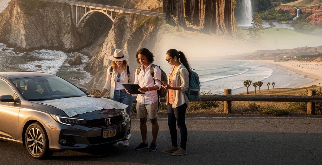
California’s diverse landscape offers one of the world’s most extraordinary road trip experiences, stretching from windswept coastal cliffs to ancient sequoia forests and dramatic desert valleys. This golden state encompasses over 163,000 square miles of terrain that shifts from fog-shrouded beaches to sun-scorched badlands within a single day’s drive. The sheer variety of ecosystems makes California a road tripper’s paradise, where you can photograph coastal lighthouses at dawn and watch the sunset illuminate snow-capped Sierra Nevada peaks by evening. With eight national parks, 280 state parks, and countless scenic byways, planning the perfect California adventure requires strategic route selection and careful timing to maximize your experience across this remarkable corridor of natural wonders.
Route planning essentials: mapping your california coastal highway 1 journey
Highway 1 stands as California’s most iconic driving route, tracing the Pacific coastline for approximately 655 miles from Mendocino to Orange County. This legendary roadway demands respect and preparation, as weather conditions, seasonal closures, and vehicle requirements can significantly impact your journey. The coastal highway’s winding nature means you’ll average 35-45 miles per hour rather than highway speeds, transforming what appears as a short distance on paper into several hours of concentrated driving. Smart route planning accounts for accommodation bookings well in advance, particularly during peak summer months when coastal towns reach capacity weeks before arrival dates.
San francisco to big sur: navigating the 145-mile scenic corridor
The journey southward from San Francisco delivers immediate rewards as Highway 1 separates from Highway 101 near Pacifica. This 145-mile stretch requires approximately four to five hours of driving time without stops, though you should allocate an entire day to properly absorb the scenery. Half Moon Bay serves as the first significant stopping point, offering pumpkin patches, coastal trails, and seafood restaurants before the road becomes more remote. The descent into Big Sur begins around Point Lobos State Natural Reserve, where dramatic granite cliffs plunge into turquoise waters creating postcard-worthy vistas at every turn. Fuel availability becomes sparse beyond Carmel, with only a handful of stations charging premium prices, making a full tank essential before entering Big Sur territory.
Big sur to san luis obispo: traversing ragged point and hearst castle territory
Beyond Big Sur’s southern boundary, Highway 1 transitions into slightly gentler terrain while maintaining spectacular ocean views for another 90 miles. Ragged Point marks a crucial rest stop with the last reliable services for 25 miles, featuring a clifftop restaurant and lodging perched 300 feet above the Pacific. Hearst Castle demands at least two hours for even the shortest tour, though architecture and history enthusiasts often spend half a day exploring William Randolph Hearst’s Mediterranean Revival masterpiece. The approach into San Luis Obispo brings rolling hills and wine country, offering a distinct change from coastal scenery. This segment typically requires three hours of driving time, though construction delays occasionally extend the journey significantly during winter storm repairs.
Santa barbara to malibu: pacific coast highway segment timing and fuel stations
The southernmost coastal segment from Santa Barbara to Malibu represents Highway 1’s most accessible and heavily trafficked portion. This 90-mile stretch offers numerous fuel stations, dining options, and beach access points, making it ideal for leisurely exploration without the isolation of northern sections. Weekend traffic transforms this route into a slow-moving parade, particularly during summer afternoons when Los Angeles residents flee urban heat for coastal breezes. The Ventura to Malibu section passes through some of California’s most pristine beaches, including El Matador State Beach with its dramatic rock formations and hidden coves. Allow three to four hours for this segment during weekdays, adding an extra hour or two on weekends when Pacific Coast Highway becomes a moving parking lot near popular surf breaks and beach clubs.
Optimal season selection: microclimates from monterey bay to orange county
California’s coastal climate varies dramatically from north to south, creating distinct seasonal advantages depending on your priorities. Spring months from April through June offer the most reliable weather across all regions, with wildflower blooms transforming hillsides into vibrant carpets while maintaining
comfortable temperatures for coastal hiking and whale watching. Summer introduces dense marine layer fog along sections from Monterey Bay to San Luis Obispo, often burning off by midday but occasionally lingering into the afternoon. South of Los Angeles, Orange County beaches tend to be sunnier and warmer, making them ideal for classic swimming and surfing days when northern sections remain cool and overcast. Autumn from September through October typically offers the clearest skies and warmest water temperatures statewide, with thinner crowds and lower accommodation rates. Winter can bring dramatic storm-driven waves and periodic road closures from landslides, so flexible itineraries and real-time Caltrans updates become essential if you plan a California coastal road trip between December and March.
Northern california’s coastal gems: from point reyes to mendocino headlands
Northern California’s coastline feels wilder and more remote than the postcard beaches of Southern California, making it ideal if you crave rugged landscapes and quieter trails. From Point Reyes to the Mendocino Headlands, you’ll encounter wind-sculpted cypress trees, working fishing harbors, and historic lighthouses perched on cliff edges. This region rewards slower travel, with frequent fog banks rolling in like a curtain that reveals and conceals sea stacks and coves throughout the day. While you can technically drive this stretch in a single day, allocating two to three days allows you to explore tide pools, sample local oysters, and photograph dramatic headlands at both sunrise and sunset. Think of this portion of your California road trip as the “fine print” of the coast—subtle, detailed, and best appreciated up close.
Point reyes national seashore: elephant seal overlooks and lighthouse trails
Point Reyes National Seashore lies just an hour north of San Francisco yet feels worlds away, with over 150 miles of hiking trails and 80 miles of shoreline. The elephant seal overlooks at Drakes Beach and Chimney Rock provide seasonal viewing platforms where you can watch these massive marine mammals during pupping and molting seasons, typically from December through March. The historic Point Reyes Lighthouse, reached by a steep stairway of more than 300 steps, offers sweeping views of the Pacific and is one of the best places in Northern California for storm-watching on blustery winter days. Fog and wind can be intense, so layering is crucial even in summer, and park officials occasionally close lighthouse access when gusts exceed safe limits. Parking lots at popular trailheads fill early on weekends, so arriving before 9 a.m. helps you secure a spot and enjoy quieter trails.
Bodega bay to fort ross: russian settlement history and tide pool exploration
The coastal route from Bodega Bay to Fort Ross combines cinematic scenery with a lesser-known chapter of California history. Bodega Bay itself, forever associated with Alfred Hitchcock’s film “The Birds,” doubles as a practical base for kayaking, crabbing, and fresh clam chowder stops. As you head north, short spur roads lead to pocket beaches and rocky promontories ideal for tide pool exploration during low tide; always check local tide charts to avoid getting trapped by incoming water. Fort Ross State Historic Park preserves the remains of an early 19th-century Russian settlement, including a reconstructed stockade and chapel that highlight the international contest for control of the Pacific Coast. Interpreted trails and exhibits explain how Russian fur traders, Native Americans, and Spanish and Mexican authorities intersected here, offering a nuanced stop that goes beyond typical coastal viewpoints.
Mendocino village: victorian architecture and glass beach phenomenon
Mendocino Village rests atop ocean bluffs, its whitewashed Victorian homes and weathered water towers evoking a New England fishing town transplanted to the Pacific. The compact downtown invites slow wandering through art galleries, cafes, and heritage buildings, many of which now operate as inns or restaurants with ocean-view dining rooms. A short drive north brings you to Fort Bragg’s famous Glass Beach, where decades of discarded glass have been tumbled by the surf into smooth, jewel-like pebbles. While collecting glass is prohibited to preserve this fragile phenomenon, photographing the colorful shoreline and learning about the region’s environmental restoration efforts offers a memorable contrast to pristine beaches farther south. For a different perspective, consider a ride on the historic Skunk Train through redwood canyons, turning your Mendocino stop into a blend of coastal and forest experiences.
Avenue of the giants: humboldt redwoods state park’s 31-mile scenic byway
North of Mendocino, the Avenue of the Giants peels away from Highway 101 to wind for 31 miles through Humboldt Redwoods State Park. This scenic byway passes some of the tallest trees on Earth, with easily accessible groves such as Founders Grove and Rockefeller Forest offering short, flat walks beneath cathedral-like canopies. Driving this route feels a bit like passing through a natural tunnel, as towering trunks block out much of the sky and sunlight filters down in narrow shafts. Numerous pullouts and picnic areas make it simple to pause for photos or a quiet lunch, and interpretive signs explain redwood ecology and conservation efforts. If you plan to integrate this detour into a broader California road trip, allow at least half a day here; the serenity and scale of the redwoods deserve more than a quick windshield tour.
Central coast highlights: monterey peninsula to santa barbara channel
The Central Coast bridges Northern and Southern California, combining dramatic headlands with softer, sandy bays and classic beach towns. Between the Monterey Peninsula and the Santa Barbara Channel, Highway 1 and Highway 101 weave through fishing harbors, wine regions, and historic missions. This is where many travelers slow their pace, using seaside towns as multi-night bases rather than constantly changing hotels. You’ll find some of the most photogenic stops on the entire California coastal road trip here, from iconic cypress trees to volcanic rock domes rising from the sea. Because distances look deceptively short, planning realistic daily mileage—typically no more than 150 to 200 miles—helps you avoid turning this scenic stretch into a rushed commute.
17-mile drive: pebble beach golf links and lone cypress landmark
The 17-Mile Drive on the Monterey Peninsula is a private scenic loop that threads through forest, coastline, and golf-course landscapes between Pacific Grove and Carmel. A vehicle entrance fee grants you access to marked viewpoints, including the Lone Cypress, a windswept tree clinging to a granite outcrop that has become one of California’s most photographed natural landmarks. You’ll also pass Pebble Beach Golf Links, consistently ranked among the top public golf courses in the United States and a pilgrimage site for golf enthusiasts. Expect frequent stops for photos, as sea lions, shorebirds, and crashing waves turn almost every turnout into a potential highlight. To avoid peak tour bus traffic, consider driving the loop early in the morning or late in the afternoon when the light is softer and parking is more plentiful.
Carmel-by-the-sea: mission san carlos borromeo del río carmelo and white sand beaches
Carmel-by-the-Sea blends storybook cottage architecture with upscale boutiques and a spacious white sand beach at the end of Ocean Avenue. Just a short drive south, Mission San Carlos Borromeo del Río Carmelo stands as one of California’s most beautifully preserved Spanish missions, with a museum and gardens that illuminate 18th-century mission life. The mission makes a compelling cultural counterpoint to the otherwise leisure-focused downtown, and its golden stone façade photographs beautifully in late-afternoon light. Carmel Beach itself is dog-friendly and ideal for sunset walks, with cypress silhouettes framing views toward Pebble Beach and Point Lobos. Parking in the village can be tight during summer weekends, so many visitors choose to park once and explore on foot, combining shopping, dining, and shoreline strolls in a single, walkable loop.
Pfeiffer big sur state park: mcway falls and purple sand beach access
Pfeiffer Big Sur State Park sits near the heart of Big Sur, offering riverfront campgrounds and trail access into the Santa Lucia Range. Nearby Julia Pfeiffer Burns State Park is home to McWay Falls, an 80-foot waterfall that drops directly onto a secluded beach—one of the most iconic images of a California coastal road trip. While beach access to McWay Falls is closed to protect fragile habitats, well-maintained overlook trails provide stunning vantage points, especially at golden hour when cliffs glow and the surf turns turquoise. A short drive away, Pfeiffer Beach is famous for its purple-tinted sand, colored by manganese garnet deposits washing down from nearby hillsides. Note that the narrow access road to Pfeiffer Beach can back up quickly, and parking is limited, so arriving early or visiting midweek greatly improves your chances of securing a spot.
Morro bay: volcanic rock formation and embarcadero waterfront district
Morro Bay’s skyline is dominated by Morro Rock, a 576-foot volcanic plug that rises abruptly from the ocean at the harbor entrance. Designated as a state preserve, the rock itself is off-limits to climbing, but surrounding beaches and the harborfront Embarcadero offer plenty of vantage points for photography. The Embarcadero district mixes working fishing docks with casual seafood restaurants, kayak rentals, and small shops, making it an ideal midday or overnight stop between Big Sur and Santa Barbara. Sea otters frequently float in the sheltered bay, and you can often spot them from waterfront walkways or rental kayaks. For those interested in birding or quieter nature trails, the Morro Bay State Park estuary and marina area provide a peaceful counterbalance to the busier harborfront.
Yosemite national park integration: eastern sierra nevada detour strategy
Incorporating Yosemite National Park into a California road trip adds alpine meadows, granite domes, and high waterfalls to your coastal itinerary. Because Yosemite lies several hours inland from the Pacific, most travelers treat it as a dedicated three- to four-day detour rather than a quick side trip. You can approach from the west via Highway 140 or Highway 41, or from the east via Highway 120 over Tioga Pass when it is open. Each route offers distinct scenery, from foothill oak woodlands to high-country lakes ringed by jagged peaks. When planning, consider park reservation systems, potential wildfire-related closures, and seasonal road conditions; Yosemite’s popularity means that spontaneous summer visits often lead to limited lodging choices and crowded trailheads.
Highway 120 tioga pass: seasonal accessibility and elevation considerations
Highway 120 over Tioga Pass is Yosemite’s only east–west crossing, connecting the park with the Eastern Sierra near Lee Vining and Mono Lake. Due to heavy snowpack, Tioga Pass typically opens sometime between late May and early July and closes again by November, though exact dates vary annually. Elevations along this route exceed 9,000 feet, which can cause mild altitude effects for some travelers, so pacing yourself and staying hydrated is important. The reward for these elevation gains includes access to Tuolumne Meadows, Tenaya Lake, and numerous trailheads that see far fewer crowds than Yosemite Valley. If you’re driving a California road trip that loops between the coast and the Eastern Sierra, timing your visit to coincide with Tioga Pass’s open season can save hours of driving compared with detouring around the southern end of the Sierra Nevada.
Tunnel view and glacier point: half dome and el capitan vantage points
Tunnel View, located near the Wawona Tunnel entrance, offers one of the most famous vistas in the United States, framing El Capitan, Bridalveil Fall, and Half Dome in a single sweeping panorama. Because it sits directly on the main park road, this viewpoint is accessible year-round and should be prioritized during your first afternoon or morning in Yosemite. Glacier Point, reached via a seasonal spur road typically open from late May through October, provides a higher, more expansive perspective over Yosemite Valley and the High Sierra beyond. Watching sunset from Glacier Point, as granite cliffs shift from gold to pink to deep purple, is often a highlight of a California national parks road trip. Parking at both viewpoints fills quickly in peak season, so consider arriving for sunrise or late evening light to enjoy fewer crowds and easier access.
Yosemite valley floor: ahwahnee hotel base camp and trailhead logistics
Yosemite Valley concentrates many of the park’s most famous landmarks within a relatively compact area, including Yosemite Falls, El Capitan, and Sentinel Rock. The historic Ahwahnee Hotel (now known as The Ahwahnee) serves as both an architectural landmark and a practical reference point, sitting within easy reach of shuttle stops and several trailheads. Staying in or near the valley dramatically reduces commute times to sunrise and sunset locations, allowing you to walk or use the free park shuttle instead of hunting for limited parking at popular stops. Trailheads for routes such as the Mist Trail, Mirror Lake, and the Valley Loop all originate from the valley floor, making it a convenient base for day hikes of varying difficulty. To make the most of your time, plan a loose daily structure—perhaps a sunrise viewpoint, a mid-morning hike, an afternoon rest, and an evening photography session—rather than attempting to see every landmark in a single, exhausting day.
Southern california desert parks: joshua tree and death valley expeditions
Transitioning from the Pacific Coast to Southern California’s desert parks reveals another side of the state’s diversity, where Joshua trees and salt flats replace cypress trees and surf breaks. Joshua Tree National Park and Death Valley National Park can be combined into a dedicated desert loop or integrated separately into a broader California road trip. Because summer temperatures frequently exceed 100°F (38°C) in both parks—and often much higher in Death Valley—spring and late autumn are generally the safest and most comfortable times to visit. Desert driving requires special preparation: extra water, sun protection, a full fuel tank, and a clear understanding of distances between services. Think of these parks as remote outposts on your itinerary where self-sufficiency matters more than it does along the well-serviced coast.
Joshua tree national park: cholla cactus garden and keys view sunrise photography
Joshua Tree National Park straddles the boundary between the Mojave and Colorado deserts, showcasing surreal rock formations and its namesake Joshua trees. The Cholla Cactus Garden, located along Pinto Basin Road, presents a dense stand of teddy bear cholla that glows dramatically when backlit at sunrise or sunset—though you’ll want to watch your step, as the spines detach easily. Keys View, perched at 5,185 feet, offers a sweeping overlook of the Coachella Valley, the San Andreas Fault, and, on clear days, the Salton Sea and distant peaks of Mexico. Many photographers favor sunrise or late-afternoon light here, when long shadows accentuate the valley’s relief and smog levels are lower. Because cell service is limited in much of the park, download offline maps in advance and carry a paper map as a backup when navigating between trailheads and viewpoints.
Death valley’s badwater basin: 282-feet below sea level navigation
Badwater Basin, the lowest point in North America at 282 feet below sea level, sits at the heart of Death Valley National Park’s otherworldly landscape. A short boardwalk leads from the parking area to expansive salt flats, where polygonal patterns in the crust create a geometric mosaic underfoot. Walking deeper onto the flats offers increasingly uninterrupted views and better photographic compositions, but in summer the heat can become dangerous within minutes; always gauge conditions carefully and avoid midafternoon excursions. Because distances within Death Valley are vast—with limited services between Furnace Creek, Stovepipe Wells, and Panamint Springs—planning fuel stops is as important here as plotting scenic stops. Navigating Badwater Basin and its neighboring viewpoints is less about complex directions and more about respecting extreme conditions, much like treating the ocean with caution during a powerful swell.
Zabriskie point to dante’s view: golden hour landscape photography positions
The drive from Zabriskie Point to Dante’s View showcases some of Death Valley’s most dramatic relief, carved by erosion into ridges and badlands. Zabriskie Point, easily accessed via a short paved path, is a classic sunrise location, where soft light rakes across serrated ridges of golden and chocolate-colored sediment. Dante’s View, perched over 5,400 feet above the valley floor, offers a bird’s-eye perspective of Badwater Basin and surrounding peaks, making it particularly compelling at sunset when shadows stretch across the salt flats. Photographers often visit both viewpoints on the same day, using Zabriskie for morning compositions and Dante’s for evening, while mid-day hours are reserved for shaded canyon hikes or rest. Strong winds and temperature swings are common at higher elevations, so layers are as important here as they are along the foggy California coast.
Sequoia and kings canyon: giant forest groves and high sierra wilderness
Sequoia and Kings Canyon National Parks, managed jointly, protect some of the largest trees on Earth and deep glacially carved valleys that rival Yosemite in drama. Located on the western slopes of the southern Sierra Nevada, these parks can be reached via mountain highways from the Central Valley cities of Visalia and Fresno. Road grades are steep and winding, with frequent switchbacks, so RV drivers and those towing trailers should review size restrictions and advisory notices before committing to certain routes. Elevations range from foothill chaparral to alpine peaks over 14,000 feet, allowing you to experience multiple life zones in a single day’s drive. Incorporating Sequoia and Kings Canyon into your California road trip adds a sense of vertical scale that complements both the horizontal expanse of the desert and the linear sweep of the coast.
General sherman tree: world’s largest living organism by volume access
The General Sherman Tree, located in Sequoia National Park’s Giant Forest, holds the title of the world’s largest tree by volume. Accessed via a paved trail and a network of nearby parking areas, this colossal sequoia stands over 275 feet tall and is estimated to be more than 2,000 years old. In peak season, a shuttle system often supplements limited parking, making it easier to reach the trailhead without circling lots in search of a space. Interpretive signs along the path explain how giant sequoias grow, resist fire, and depend on specific soil and moisture conditions, helping you appreciate that you’re not just seeing a big tree but an entire specialized ecosystem. Visiting early or late in the day not only reduces crowds but also provides softer light that emphasizes the tree’s reddish-brown bark and the surrounding grove’s cathedral-like atmosphere.
Moro rock: 400-step granite dome ascent and panoramic valley views
Moro Rock offers one of the most accessible high viewpoints in Sequoia National Park, reached by climbing approximately 400 stone steps carved into a granite dome. The trail is short but steep and includes railings along exposed sections, so those with severe height sensitivities may find it challenging despite its modest distance. On clear days, the summit delivers sweeping views of the Great Western Divide and the deep valleys carved below, making it a favorite spot for sunset photography and stargazing. Afternoon thunderstorms can build quickly in summer, and rangers advise avoiding the exposed summit during lightning risk, underscoring the importance of checking forecasts before starting your ascent. Because parking is limited near the trailhead, many travelers combine a shuttle ride with their Moro Rock visit, integrating it into a broader loop that also includes the Giant Forest Museum and other short walks.
Kings canyon scenic byway: cedar grove village and zumwalt meadow loop
The Kings Canyon Scenic Byway (Highway 180) penetrates deep into one of North America’s deepest canyons, following the South Fork of the Kings River into Cedar Grove. This seasonal road, typically open late spring through autumn, offers a series of turnouts where you can stop to photograph sheer granite walls, cascading rivers, and dense conifer forests. Cedar Grove Village provides basic services—lodging, a small market, and picnic areas—making it a logical base for exploring the canyon’s day hikes. The Zumwalt Meadow Loop, a relatively easy trail that circles a lush meadow beneath towering cliffs, showcases the park’s mix of river, forest, and open grassland in a compact circuit. When integrated into a multi-park California road trip, the Kings Canyon Scenic Byway acts like a grand finale to the Sierra section of your journey, delivering big-mountain scenery without the same level of crowding often found in Yosemite Valley.