Amsterdam’s transport network represents one of Europe’s most sophisticated urban mobility systems, yet navigating it efficiently requires understanding the nuances that separate tourists from residents. The city’s concentric canal structure, extensive cycling infrastructure, and integrated public transport options create a movement ecosystem that rewards preparation and local knowledge. Whether you’re planning a short visit or an extended stay, mastering Amsterdam’s transport fundamentals will transform your experience from logistically frustrating to genuinely liberating.
The Dutch capital accommodates approximately 18 million overnight visitors annually, placing enormous pressure on its historic street network and public transport capacity. During peak tourist seasons, uninformed navigation choices can add hours to your daily itinerary and significantly diminish your enjoyment. Locals have developed specific strategies for moving through their city efficiently—strategies based on decades of collective experience with canal geography, rush-hour patterns, and seasonal weather variations.
Understanding Amsterdam’s transport ecosystem begins with recognising that different modes serve different purposes throughout your day. The morning commute demands different strategies than afternoon museum visits, whilst evening activities require yet another approach. This comprehensive guide decodes the systems that locals use instinctively, providing you with practical knowledge that typically takes months of residence to acquire naturally.
Mastering amsterdam’s OV-Chipkaart contactless payment system
The OV-chipkaart functions as the Netherlands’ national public transport payment card, operating across trains, trams, metros, buses, and some ferries throughout the country. Amsterdam’s implementation of this system integrates seamlessly with the GVB (Gemeentelijk Vervoerbedrijf) municipal transport network, though understanding its operational mechanics prevents the common frustrations that plague first-time users. The card exists in two primary formats: the personal variant linked to your identity, and the anonymous version available to tourists and short-term visitors.
Recent technological developments have introduced OVpay, a contactless payment option allowing direct card tapping without purchasing a physical OV-chipkaart. This system accepts major credit cards, debit cards, and smartphone payment applications, calculating fares automatically based on your journey. However, the traditional OV-chipkaart remains advantageous for extended stays, offering greater flexibility and avoiding potential foreign transaction fees that some banks apply to contactless payments. Statistical data from GVB indicates that approximately 68% of Amsterdam residents still prefer the traditional chipkaart despite OVpay’s convenience, primarily due to better fare management and the ability to load discount subscriptions.
Purchasing and loading your OV-Chipkaart at GVB service points
Anonymous OV-chipkaarts are available at GVB service counters located within major metro stations, Centraal Station, and numerous tobacco shops (recognisable by their brown “Tabak” signs) throughout the city. The card itself costs €7.50, which represents a non-refundable administrative charge separate from travel credit. Initial loading requires a minimum balance of €20 for train travel or €4 for metro, tram, and bus journeys—a distinction that confuses many visitors attempting to use their newly purchased card on NS rail services.
Loading additional credit onto your card can be accomplished through yellow GVB ticket machines found at tram stops and metro stations, through the GVB website for registered cards, or at Albert Heijn supermarkets equipped with OV-chipkaart terminals. The machines accept coins, banknotes, and contactless bank cards, though they notoriously reject worn or folded notes. Loading your card during off-peak hours at quieter stations prevents the queue pressure that often leads to transaction errors and frustration.
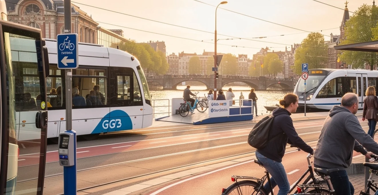
Check-in and Check-Out protocol for trams, metros, and buses
Amsterdam’s public transport operates on a distance-based fare system requiring both check-in and check-out actions. Yellow card readers positioned at vehicle entrances and station gates emit a green light and confirmatory beep when successfully processing your check-in. Failure to check out at your destination results in the maximum fare charge for that transport mode—currently €4 for GVB services—regardless of distance travelled. This “punishment fare” system generated approximately €2.3 million in additional revenue for GVB during 2024, predominantly from tourists unfamiliar with the protocol.
Tram check-in readers are located beside each door,
and you can use any door to board or exit. On buses, readers are typically clustered near the front entrance beside the driver, while on the metro you must tap through physical gates at both entry and exit. Locals develop the habit of tapping out the moment they step off a tram or bus, before checking their phone or orienting themselves, which helps avoid accidental missed check-outs. If you realise you have forgotten to check out, you can recover part of the overcharge by registering your card online and submitting a correction request within six months.
Understanding credit requirements and fare calculation methods
GVB fares on the OV-chipkaart combine a fixed boarding fee with a per-kilometre charge that is calculated using GPS and route data. For metro, tram, and bus journeys within Amsterdam, the system temporarily reserves a higher amount from your card balance at check-in (typically around €4) and then refunds the unused portion when you check out. This is why having the minimum required credit on your card before starting your journey is essential; if your balance is below the threshold, the reader will refuse your check-in even if your actual trip would cost less.
Distances are measured along the official route, not “as the crow flies,” which means that detours or diversions do not change the fare you pay. Children aged 4–11 can benefit from discounted day tickets, while adults who expect to make numerous journeys in a single day may find that a 1–3 day GVB pass delivers better value than pay-as-you-go chipkaart fares. When comparing the Amsterdam Travel Ticket, GVB day passes, and OVpay, consider how often you will cross the city rather than simply counting calendar days; a three-day stay with one heavy transit day and two mostly walking days may not justify an all-inclusive ticket.
Troubleshooting declined transactions and card malfunctions
When a check-in attempt fails, the card reader will display a red light and an error message in Dutch, often accompanied by a different tone. The most frequent cause is insufficient balance, which you can confirm at any ticket machine or service point by inserting or tapping your card. If your balance is adequate but the reader still refuses you, try another reader on the same vehicle or gate; occasionally, individual units malfunction or lose connectivity. Persistent issues suggest that the card chip may be damaged, especially if it has been bent in a wallet or exposed to moisture.
In such cases, visit a GVB service desk where staff can test the card and, if necessary, transfer remaining credit to a new one. For OVpay users, declined transactions usually relate to bank security protocols or foreign-transaction settings rather than the Dutch system itself. Contacting your bank before travel to authorise contactless payments in the Netherlands prevents many of these problems. If a tap was declined but you still boarded, inform the driver or conductor immediately and either tap successfully at the next stop or purchase a paper ticket to avoid travelling without a valid fare.
Navigating amsterdam’s cycling infrastructure and bike rental networks
Cycling in Amsterdam is both a practical transport solution and a cultural experience, but it operates on a dense, fast-moving infrastructure that assumes a certain level of confidence. For locals, the fiets (bicycle) is an extension of personal space and daily routine, used for commuting, shopping, and social visits. For visitors, integrating into this system safely means understanding not only where to rent a bike, but also how the rules, markings, and unwritten etiquette work in real time. By approaching Amsterdam cycling with the same respect you would give to a new driving environment, you dramatically increase both your safety and your enjoyment.
Selecting between swapfiets, MacBike, and black bikes rental services
Amsterdam offers an abundance of bike-rental options, yet the three most recognisable networks—Swapfiets, MacBike, and Black Bikes—cater to slightly different needs. Swapfiets is primarily designed for long-term residents and internationals staying several months; it operates on a subscription model where you pay a fixed monthly fee in exchange for a maintained bicycle that is swapped if it breaks. Visitors on shorter stays usually gravitate toward MacBike and Black Bikes, both of which offer daily and multi-day rentals from multiple central locations. MacBike is known for its bright red bicycles and tourist-friendly service, including maps and route suggestions.
Black Bikes positions itself as the more “local” alternative, renting out traditional Dutch-style city bikes that blend in better with Amsterdam traffic and are available from over a dozen outlets. Prices are broadly similar, usually starting around €10–15 per day, with discounts for longer rental periods. When choosing between providers, consider opening hours near your accommodation, included insurance options, and the availability of hand brakes versus coaster (back-pedal) brakes, which some visitors find unfamiliar. You may also want to ask for a slightly smaller frame if you are not used to the tall geometry of Dutch bikes; better control often matters more than aesthetics.
Decoding fietspad markings and priority rules at junctions
The backbone of Amsterdam cycling is the fietspad—dedicated bike paths typically surfaced in red asphalt and marked with a white bicycle symbol. At many junctions, cyclists have their own traffic lights, which display small bicycle icons instead of standard red-amber-green circles. As a rule of thumb, if you are on a marked fietspad separated from the road, you follow your own signals and crossings rather than copying nearby cars or pedestrians. Where there is no separate path, cyclists share the lane with vehicles and must obey the main traffic lights.
Priority rules can feel counterintuitive at first. In residential streets marked as woonerf or shared spaces, cars are “guests” and must adapt to cyclists and pedestrians, while on larger roads cyclists yield when joining from side streets unless otherwise signed. A general principle is that traffic from the right has priority, but tram tracks and designated priority roads often override this with clear signage and road markings. Observing locals for a few minutes at a busy intersection can be as instructive as any rulebook; you will notice that assertiveness is combined with predictability, not with sudden manoeuvres. Think of Amsterdam’s cycling system like a river: it works best when every “current” flows smoothly and signals its direction early.
Securing your bicycle with ART-approved locks in high-theft zones
Amsterdam’s high bicycle density unfortunately correlates with one of Europe’s highest bike-theft rates, especially around major transport hubs and nightlife districts. Locals mitigate this by using at least two locks: the built-in frame lock (ring lock) that immobilises the rear wheel, and a separate chain or U-lock to secure the frame to a fixed object. When renting, insist on a bike that comes with both types of lock and ask staff to demonstrate correct usage if you are unsure. ART-approved locks—certified by a Dutch testing institute—offer higher resistance against common theft tools and are often required for insurance coverage.
High-risk zones include Amsterdam Centraal, Leidseplein, Rembrandtplein, and the areas around major markets such as Albert Cuyp. Here, you should always attach your bicycle to an official rack rather than a random rail or fence; bikes parked illegally can be removed by the city’s enforcement teams and taken to a central depot, requiring both a fee and considerable time to recover. As a rule, never leave a rental bike unlocked even for a “quick” photo stop, and avoid overnight parking in dark side streets when secure indoor storage is available. Treat your rented bicycle as you would a hire car: with cautious respect and a clear sense of responsibility.
Utilising fietsenstalling facilities at centraal station and sloterdijk
To cope with tens of thousands of daily cyclists, Amsterdam has invested heavily in fietsenstalling—structured bicycle parking facilities that range from simple covered racks to multi-level underground garages. Amsterdam Centraal now features a state-of-the-art underwater fietsenstalling accessible from the front of the station, offering secure parking for around 7,000 bikes. The first 24 hours are typically free for most users, with modest charges thereafter, and the facility is monitored and well-lit, making it a logical choice if you are arriving or departing by train. Clear wayfinding signs guide you from the platforms to the bike parking areas, and entry works simply by rolling your bike through automated gates.
Station Sloterdijk, a key interchange in the west of the city, also offers extensive covered bike parking with direct access to train and bus platforms. Using these official facilities not only reduces theft risk but also keeps sidewalks and station forecourts clear, which is a major priority in Amsterdam’s transport planning. If you are planning to combine cycling with regional rail trips—perhaps visiting Haarlem or Zandvoort—locking your city bike in a fietsenstalling before boarding the train is often more practical than taking the bike with you. Think of these facilities as park-and-ride hubs for bicycles rather than cars, aligning perfectly with Amsterdam’s car-light urban philosophy.
Deciphering GVB tram routes through concentric canal rings
Amsterdam’s tram network operates like a series of spokes radiating from and circling around the historic canal ring, linking neighbourhoods such as Jordaan, De Pijp, and Oud-West with central hubs. Understanding this geometry turns what can look like a confusing spider’s web into a surprisingly logical system. Most routes pass through or near Amsterdam Centraal, Dam Square, or Leidseplein, giving you multiple options for crossing the city without lengthy walks. Locals rarely memorise full timetables; instead, they internalise which lines serve which axes and which squares function as the most efficient interchange points.
Strategic interchange points at leidseplein and dam square
Leidseplein operates as one of the city’s most important tram junctions, positioned at the gateway to the Museum Quarter and the nightlife zones of Oud-West. Lines such as 1, 2, 7, and 19 intersect here, allowing you to transfer between routes heading toward Slotervaart, Nieuw-West, and the museums within a matter of minutes. From a visitor’s perspective, this means you can reach the Rijksmuseum, Vondelpark, and De Hallen food market with minimal walking if you treat Leidseplein as your anchor point. The square itself is compact enough that changing between stops rarely takes more than a two-minute walk.
Dam Square, located a short distance south of Centraal Station, functions as another high-value interchange node. Here, lines 4, 14, and 24 provide rapid links to De Pijp, Oost, and the RAI convention centre, while other routes connect to Jordaan and the western canals. Because Dam Square is usually less chaotic than the immediate surroundings of Centraal, many locals prefer to walk or tram from the station to Dam and then make their connection, rather than navigating multiple tracks and platforms in front of the station. If you think of Amsterdam’s tram network as an hourglass, Centraal and Leidseplein are the wide ends while Dam Square is the narrow, strategic middle.
Night tram services along routes 12, 14, and 17
While Amsterdam’s standard tram services generally wind down around midnight, night routes fill some of the gaps, especially on weekends and during major events. Lines such as 12, 14, and 17 provide extended coverage, ensuring that key corridors between the city centre, Oost, and western neighbourhoods remain accessible after concerts, theatre performances, and late dinners. Timetables are reduced, with trams running less frequently—often every 20 to 30 minutes—so checking the GVB app or 9292 journey planner becomes particularly important at these hours. You will also notice increased security presence and more visible conductors on board.
For travellers staying in areas like Oud-West, De Baarsjes, or near the Olympic Stadium, understanding which night routes serve your closest stop can determine whether you opt for public transport or a taxi after midnight. Keep in mind that some lines change route numbers or partial segments in night mode, so do not assume that the same tram number you used at 3 pm will behave identically at 1 am. As a precaution, always verify the final destination displayed on the front and side of the tram before boarding, especially when you are tired. A 10-second double-check can save you a 30-minute detour.
Avoiding tourist congestion on lines 2 and 5 during peak hours
Tram lines 2 and 5 are famously scenic, passing many of Amsterdam’s most iconic sights including the Canal Ring, Museumplein, and the high-end shopping street PC Hooftstraat. International travel guides often highlight route 2 as one of the world’s most beautiful tram rides, which inadvertently concentrates tourist demand along this corridor. During peak visitor seasons and rush hours, these lines can become uncomfortably crowded, making boarding with luggage, strollers, or mobility aids particularly challenging. Locals who need to move efficiently often avoid these lines during the late morning and mid-afternoon windows when museum traffic peaks.
To move like a resident, consider using parallel routes or walking a block or two to alternative stops. For example, instead of taking line 2 from Centraal to the Rijksmuseum, you might take line 24 or 12 and walk a slightly longer but less congested final stretch. Similarly, if your accommodation is near the Museum Quarter, using early-morning or late-evening trams can dramatically reduce crowding. Remember that the “most popular” tram is not necessarily the best one; sometimes the quickest way to cross Amsterdam is by choosing the route that travel blogs never mention.
Amsterdam metro system integration with Noord-Zuidlijn and ring lines
Amsterdam’s metro system, while smaller than those of cities like London or Paris, is finely tuned to complement trams and buses rather than replace them. The opening of the Noord-Zuidlijn (North–South Line, metro 52) in 2018 fundamentally reshaped how residents travel between Amsterdam Noord, the historic centre, and the rapidly developing Zuidas business district. Meanwhile, the older east–west and southeast lines create a loose “ring” around the central area, connecting stadiums, residential zones, and parklands. When you learn to combine metro, tram, and ferry intelligently, cross-city journeys that once took 40 minutes by surface routes can shrink to 15–20 minutes underground.
Rapid transit between zuid station and amsterdam noord
Metro 52, the Noord-Zuidlijn, is the backbone of rapid north–south movement in Amsterdam. Running from Noord to Zuid Station in roughly 15 minutes, it slices beneath the IJ and Canal Ring, stopping at key central locations such as Centraal Station, Rokin, Vijzelgracht, and De Pijp. For business travellers staying near the Zuidas or visitors attending conferences at the RAI, this line offers a predictable, high-frequency service that is largely unaffected by surface traffic. Trains generally arrive every 4–7 minutes during the day, reducing the need to consult timetables.
For those based in Amsterdam Noord, metro 52 dramatically simplifies access to museums, shopping streets, and nightlife south of the river. Instead of relying solely on ferries, you can board at Noord station with secure bike parking, ride underground to De Pijp for dinner, and return via Centraal and the Buiksloterweg ferry if you prefer a scenic route home. Think of the Noord-Zuidlijn as Amsterdam’s “express spine”: when you are planning any journey that crosses the river and continues beyond the immediate centre, check first whether metro 52 can form the core of your route.
Metro 51, 53, and 54 connections to bijlmer arena and gaasperplaas
The southeastern branch of Amsterdam’s metro network—lines 51, 53, and 54—links the inner city with major entertainment and residential zones such as Amsterdam Bijlmer Arena, Holendrecht, and Gaasperplas. Metro 54 runs from Gein through Bijlmer Arena and Amstel to Centraal, serving the large Johan Cruijff ArenA stadium, AFAS Live concert hall, and the Ziggo Dome. On event nights, trains are heavily reinforced and crowds substantial, so arriving one or two services earlier than strictly necessary can prevent stressful platform bottlenecks. Metro 53 heads toward Gaasperplas, a recreational lake area popular in summer for picnics and waterside walks.
Metro 51, partially converted to a full metro after previously operating as a hybrid tram-metro, integrates with these lines to maintain frequent service along overlapping sections. For visitors staying in budget hotels in Zuid-Oost or attending trade shows at nearby venues, these routes often provide the fastest path into the centre, especially during rush hour when surface traffic slows. Because the southeastern metro lines run mainly above ground outside the core, they also offer interesting glimpses into Amsterdam’s more modern architecture and multicultural neighbourhoods—areas often missed by visitors who never leave the Canal Ring.
Coordinating metro-to-ferry transfers at centraal station
Centraal Station is the nexus where Amsterdam’s metro system meets its free IJ ferries, creating a unique multi-modal junction between underground and waterborne transport. After exiting metro 52, 51, 53, or 54 at Centraal, clear signage directs you towards the IJzijde (IJ-side) of the station, where ferry terminals line the waterfront. The transfer from metro platform to ferry dock usually takes 5–8 minutes on foot, including time to navigate escalators, corridors, and the main concourse. Because ferries operate on high frequency—often every 4–6 minutes on the busiest routes—you rarely need to time your arrival precisely.
When planning journeys that involve both metro and ferry, it helps to think in terms of “blocks” of 15 minutes rather than exact departure times. For example, from De Pijp to NDSM, you might allow 5 minutes to reach the metro, 10 minutes on metro 52 to Centraal, 7 minutes to walk to the rear exits, and another 10 minutes including ferry waiting and crossing. Building this buffer into your mental schedule avoids the anxiety of sprinting through corridors or fearing that a missed ferry will derail your entire evening. Integration between modes is designed to be forgiving: you do not pay extra for ferries, and minor delays on one leg tend to be absorbed naturally into the next.
Utilising free GVB ferry services across the IJ waterway
The ferries that shuttle back and forth across the IJ behind Centraal Station are among Amsterdam’s most distinctive—and most underrated—transport assets. Operated by GVB and free for all users, these vessels connect the dense historic centre with the rapidly developing northern bank, home to cultural institutions, creative districts, and residential areas. For many locals, the daily ferry ride functions as a brief reset, a few minutes of open water and fresh air between work and home. For visitors, mastering the ferry network opens up a side of Amsterdam that feels markedly different from the canal belt: more experimental, more spacious, and more industrial.
Buiksloterweg ferry route to amsterdam noord cultural district
The Buiksloterweg ferry is the shortest and most frequently used crossing, linking the rear of Centraal Station with the waterfront promenade in Amsterdam Noord. The crossing itself takes just about 2–3 minutes, and sailings depart every few minutes throughout most of the day and evening. Once on the northern side, you are within a short walk of major attractions such as the Eye Filmmuseum, A’DAM Lookout tower, and various waterfront bars and restaurants. Because the route is so short and frequent, locals treat it almost like an extension of the sidewalk rather than a scheduled service.
For travellers staying in Noord or those planning a day exploring its architecture, parks, and eateries, the Buiksloterweg ferry becomes the default connector to the rest of the city. No ticket or tap-in is required: you simply roll or walk on and off. However, boarding and disembarking can be hectic during rush hours, with large flows of cyclists moving in both directions. To keep things smooth and safe, stand to the side when entering or exiting if you are on foot, allowing bikes to move first, much as you would let cars clear a slip road before crossing.
NDSM ferry access to creative industrial zones and food markets
Further west along the IJ, the NDSM ferry offers a longer, more scenic crossing to the former shipyard district of NDSM-Werf. This area has transformed from an industrial site into a creative hotspot, home to artist studios, cultural venues, street art, and popular food halls and markets. The crossing from Centraal typically takes around 14 minutes, providing expansive views of the city skyline, docklands, and passing cargo traffic. Services are less frequent than the Buiksloterweg route, usually running every 15–30 minutes depending on time of day, so a quick timetable check is sensible before you arrive at the pier.
Once at NDSM, you will find ample space to cycle or stroll, with wide quays, open squares, and waterfront terraces ideal for long lunches or evening drinks. Events such as flea markets, music festivals, and open-air cinema screenings frequently populate the calendar here, making the ferry ride itself feel like a gateway to a different Amsterdam. Because the journey is longer, it can be particularly pleasant in late afternoon golden light or on warm summer evenings—think of it as a free mini-cruise included with your stay.
Cycling onboard regulations and peak-time capacity restrictions
Ferries across the IJ are designed to accommodate large volumes of cyclists alongside pedestrians, but capacity is not unlimited. During morning and evening rush hours, GVB may temporarily limit the number of bikes admitted on each sailing to ensure safe loading and stability. Cyclists queue in designated lanes and are expected to dismount before boarding, walking their bikes onto the vessel and positioning them in marked areas. If you are on foot, it is wise to avoid standing in these bike lanes while waiting, as the flow of two-wheeled traffic can be surprisingly intense.
On some routes, cargo bikes and scooters are also permitted, though e-scooters and certain motorised vehicles face stricter rules, which are clearly indicated by signage at the docks. As a visitor, following the lead of locals—where they line up, when they mount or dismount, how they position their bikes—will help you integrate smoothly. If a ferry looks crowded and you are not in a rush, simply wait for the next one; with free fares and frequent departures, the marginal time cost is low, and your stress levels will remain lower too.
Walking routes through jordaan, de pijp, and Oud-West neighbourhoods
Despite its sophisticated public transport and cycling infrastructure, Amsterdam remains at heart a walking city—at least in carefully chosen doses. The most rewarding neighbourhoods for pedestrians are those where cars are scarce, canals are narrow, and local life spills naturally onto the streets and terraces. Jordaan, De Pijp, and Oud-West each offer distinct atmospheres while sharing a common trait: they reveal their charm most fully at walking speed. Knowing which corridors and side streets to follow helps you thread these areas together without constantly consulting a map.
Pedestrian navigation via negen straatjes and utrechtsestraat corridors
Jordaan’s western flank blends almost seamlessly into the Negen Straatjes (Nine Streets), a compact grid of boutique-lined streets that cross the main canals between Singel and Prinsengracht. This area serves as a perfect pedestrian corridor between the old centre and Jordaan, allowing you to move westward while browsing independent shops, cafés, and galleries. By following a rough zigzag pattern through these nine streets, you experience a cross-section of canal architecture without needing to tackle major traffic arteries. It’s one of the best ways to “move while lingering,” covering distance without feeling rushed.
On the opposite side of the centre, Utrechtsestraat performs a similar role, linking Rembrandtplein and the inner canals with De Pijp and the Amstel riverfront. This narrow, lively street hosts a mix of specialty food shops, bars, and design boutiques, and forms a useful spine if you are walking from the centre toward De Pijp or vice versa. Instead of trying to cut diagonally through small side streets, following Utrechtsestraat for most of the way simplifies your navigation and keeps amenities close at hand. Think of Negen Straatjes and Utrechtsestraat as two of Amsterdam’s most efficient “walking escalators,” gently carrying you from one neighbourhood to the next.
Understanding shared-space zones and right-of-way protocols
Many of Amsterdam’s most appealing streets are designated as shared-space or low-traffic zones, where traditional distinctions between roadway and sidewalk blur or disappear. In areas marked as woonerf or with blue residential-zone signs, cars are permitted but must travel at walking pace and yield to both pedestrians and cyclists. For visitors, this can initially feel disorienting: where exactly are you supposed to walk when there is no raised pavement? The practical answer is to stay toward the building side of the street when possible, stepping aside predictably when bikes or cars approach.
Right-of-way in shared spaces relies heavily on eye contact and courtesy rather than strict lane discipline. If in doubt, pause briefly and allow faster traffic to pass in front of you; locals will usually acknowledge with a nod or small hand gesture. At uncontrolled intersections, vehicles from the right generally have priority, but trams and main roads may override this with clear signs and road markings. By moving at an unhurried, predictable pace and avoiding sudden lateral changes, you fit naturally into the subtle choreography that makes Amsterdam’s shared streets function.
Avoiding cycle path encroachment fines and zebra crossing etiquette
One of the most common—and most dangerous—mistakes made by visitors is unintentionally stepping into cycle lanes while distracted by views or smartphones. Because fietspaden are often level with the sidewalk and visually separated only by colour or a thin curb, it is easy to drift into them without noticing. Cyclists travel quickly and expect their lanes to remain clear; near collisions are common when pedestrians suddenly change direction. In addition, municipal enforcement has become stricter in recent years, and in theory fines can be issued for obstructing bike paths or crossing outside designated points in high-risk areas.
To move safely and respectfully, treat red asphalt surfaces with bicycle symbols as “live lanes” at all times and only cross them at zebra crossings or clear gaps, much as you would a car lane. At zebra crossings themselves, pedestrians technically have right of way over cars and bikes, but local practice leans on mutual awareness: look both ways, make eye contact with approaching cyclists, and step forward only when you see them slowing. Using these small habits, you can explore Amsterdam’s neighbourhoods on foot with the easy confidence of someone who understands not just where to go, but how the city moves around them.