# The Azores remain one of Europe’s best-kept natural secrets
Scattered across the North Atlantic Ocean like emerald jewels on a vast blue canvas, the Azores archipelago represents one of the most extraordinary natural environments accessible from mainland Europe. This Portuguese autonomous region, comprising nine volcanic islands positioned approximately 1,500 kilometres west of Lisbon, has quietly earned recognition as a premier destination for nature enthusiasts, adventure seekers, and those yearning for authentic, unspoiled landscapes. Unlike the Mediterranean’s crowded coastal resorts, these islands maintain an untouched character that feels almost prehistoric in its raw beauty. The archipelago’s relative isolation has preserved not only its geological wonders but also its unique ecosystems, making it an increasingly important location for biodiversity conservation and sustainable tourism development. What makes the Azores truly remarkable is the concentration of natural phenomena: active geothermal systems, endemic species found nowhere else on Earth, year-round cetacean populations, and dramatic volcanic topography all within a compact geographical area accessible via modern air travel.
Volcanic archipelago geography: são miguel, terceira, and faial’s geological formation
The Azores archipelago owes its existence to the complex tectonic interactions occurring at the junction of three major crustal plates: the Eurasian, African, and North American plates. This triple junction creates one of the most geologically active regions in the Atlantic Ocean, with volcanic activity that continues to shape the islands today. The archipelago stretches over 600 kilometres from Santa Maria in the southeast to Corvo in the northwest, with each island displaying distinct geological characteristics reflecting different stages of volcanic evolution. São Miguel, the largest island spanning 747 square kilometres, showcases the full spectrum of volcanic features, from towering stratovolcanoes to collapsed calderas now filled with pristine lakes.
The formation of these islands occurred over millions of years through submarine volcanic eruptions that gradually built massive volcanic structures from the ocean floor, which rises from depths exceeding 4,000 metres. This process created islands with steep coastal cliffs, rugged interiors, and fertile volcanic soils that support the lush vegetation characteristic of the archipelago. Terceira Island, covering 403 square kilometres, demonstrates a different geological profile with its four principal volcanic systems, including the massive Cinco Picos stratovolcano that dominates the island’s interior. The island’s relatively flat central plateau contrasts sharply with São Miguel’s more dramatic topography, illustrating the diversity within the archipelago’s volcanic landscapes.
Caldeira das sete cidades: twin crater lakes and volcanic cone structure
Located on São Miguel’s western flank, the Caldeira das Sete Cidades represents one of the most visually stunning volcanic features in the entire Azorean archipelago. This massive crater, measuring approximately 12 kilometres in circumference and plunging to depths of 350 metres below the rim, formed during a catastrophic eruption roughly 22,000 years ago. The collapse of the volcanic structure created a vast caldera that subsequently filled with water, creating the twin lakes—Lagoa Azul and Lagoa Verde—separated by a narrow bridge. The distinct colouration of these adjacent water bodies, one appearing blue and the other green depending on light conditions and algae concentrations, creates a phenomenon that attracts photographers and nature enthusiasts from around the world.
Within the caldera, several smaller volcanic cones demonstrate the ongoing geological processes that shape the landscape. These secondary eruptive centres, formed during post-caldera volcanic activity, create a complex terrain of hills, ridges, and smaller crater lakes. The rim of the caldera offers spectacular viewpoints, particularly from Vista do Rei, where you can observe the entire collapsed structure and appreciate the scale of the geological forces that created this natural amphitheatre. The fertile volcanic soils within the caldera support agricultural activities, with small farms dotting the crater floor alongside the picturesque village of Sete Cidades.
Algar do carvão: subterranean magma chamber exploration on terceira island
Terceira Island’s Algar do Carvão provides a rare opportunity to descend into an ancient volcanic chimney and explore the interior workings of an extinct volcano. This geological
chimney that once channelled magma to the surface. Today, visitors can safely descend around 90 metres into this ancient conduit, entering a vast, cathedral-like chamber adorned with stalactites and stalagmites formed not from limestone, but from silica-rich materials deposited by infiltrating rainwater. The partially collapsed roof permits natural light to penetrate the upper sections, creating an almost otherworldly atmosphere where mosses and ferns cling to the damp volcanic walls. As you follow the illuminated pathways and staircases, you gain a tangible sense of the island’s volcanic origins, walking quite literally through the heart of a former magma chamber that solidified more than 3,000 years ago.
For geologists and curious travellers alike, Algar do Carvão offers a rare window into the internal architecture of a volcanic edifice. Unlike many lava tubes, this structure allows you to see the transition from the former vent down to a small underground lake at the bottom, where rainwater accumulates in a crystal-clear pool. Interpretation panels and guided tours explain how gas-rich magma once surged through this conduit, and how subsequent erosion and chemical weathering sculpted the void we see today. It is an ideal stop for anyone interested in volcanic tourism in the Azores, and a powerful reminder of how dynamic terrestrial processes can create both destructive eruptions and breathtaking subterranean landscapes.
Capelinhos volcano: 1957-58 eruption impact on faial’s western peninsula
On the western tip of Faial Island, the Capelinhos Volcano presents one of the most striking examples of recent volcanic activity in the Azores. Between 1957 and 1958, a series of submarine eruptions gradually built a new volcanic cone just off the coast, ejecting ash, scoria, and lava that eventually connected to Faial’s shoreline. Over 13 months, this eruption enlarged the island by approximately 2.4 square kilometres, while burying fields, farms, and part of the existing lighthouse in layers of ash up to 30 metres thick. For local communities, the eruption was both a humanitarian and economic crisis, leading to the emigration of thousands of Azoreans, particularly to North America.
Today, Capelinhos resembles a lunar landscape, with barren slopes of ash and cinders stretching down to the Atlantic, offering visitors a raw, almost surreal environment to explore. The Capelinhos Interpretation Centre, built largely underground to minimise visual impact, provides detailed exhibits on the eruption’s chronology, the science of Surtseyan (submarine-to-subaerial) eruptions, and the human stories of displacement and adaptation. Walking across the ash fields, you can still see the stark contrast between the older, vegetated terrain and the younger volcanic deposits, whose sparse pioneering plants are slowly reclaiming the landscape. Standing near the half-buried lighthouse, you witness how quickly volcanic processes can redraw coastlines and reshape human destinies in this remote Atlantic archipelago.
Furnas valley geothermal activity: fumaroles and thermal spring systems
On São Miguel, the Furnas Valley is one of the most active geothermal areas in the Azores, showcasing bubbling mud pools, steaming fumaroles, and mineral-rich hot springs within a single, compact basin. This volcanic depression, part of the Furnas Volcano complex, has experienced at least two major eruptions in the last 5,000 years, the most recent occurring in 1630. Today, rather than explosive eruptions, the dominant expressions of subterranean heat are hydrothermal: superheated water and gases rise through fractures in the rock, emerging as steam vents and boiling springs at the surface. The result is a landscape that appears constantly in motion, with rising plumes of steam and the distinctive scent of sulphur reminding you that magma still lurks at depth.
For visitors, Furnas combines scientific interest with wellness tourism in a way few European destinations can match. Around Lagoa das Furnas, traditional “cozido” stews are slow-cooked underground in sealed pots buried in the hot soil, where temperatures can exceed 90°C just below the surface. In the nearby village, thermal bathing complexes such as Terra Nostra Garden and Poça da Dona Beija offer milky-orange pools enriched with iron and other minerals, surrounded by lush subtropical vegetation nourished by the valley’s fertile soils. If you ever wondered what it feels like to soak in naturally heated volcanic waters while watching steam rise from fumaroles across the valley floor, Furnas provides that exact experience in a safe, carefully managed setting.
Endemic biodiversity hotspot: macaronesian laurel forest ecosystems
Beyond its dramatic volcanoes, the Azores archipelago forms part of the broader Macaronesian biogeographical region, which also includes Madeira, the Canary Islands, and Cape Verde. This region is renowned for its laurel forest ecosystems, or Laurisilva, relics of subtropical forests that once covered large parts of southern Europe during the Tertiary period. In the Azores, fragments of these ancient forests survive on the more humid, windward slopes of islands like São Miguel, Terceira, Pico, and Flores, where persistent cloud cover and high rainfall create ideal conditions for mosses, ferns, and broadleaf evergreen trees. Although much of the original native forest has been replaced by pastures and exotic tree plantations, ongoing conservation programmes are working to restore and expand these critical habitats.
Why does this matter for travellers and nature enthusiasts? These laurel forests harbour a high proportion of endemic species—plants, birds, and invertebrates that evolved in isolation and occur nowhere else on Earth. Walking through a well-preserved patch of Azorean Laurisilva can feel like stepping back in time, as if entering a living museum of Europe’s prehistoric flora. Mist-laden branches draped with lichens, carpets of liverworts underfoot, and the calls of elusive forest birds create an immersive sensory experience. For those interested in sustainable travel and biodiversity-rich destinations, understanding and supporting the conservation of these Macaronesian laurel forests is key to ensuring that the Azores remain one of Europe’s best-kept natural secrets.
Azorean bullfinch conservation in são miguel’s native vegetation zones
One of the most emblematic species tied to these native forests is the Azorean bullfinch (Pyrrhula murina), known locally as the Priolo. This small passerine bird is endemic to São Miguel and, for many years, was considered one of the rarest birds in Europe, restricted to a very limited area in the island’s eastern highlands. Its fate became closely linked to the survival of native vegetation zones, as it relies on indigenous plants for food and nesting. In the late 20th century, extensive clearing of native forest for pastures and the spread of invasive plant species pushed the Azorean bullfinch to the brink of extinction.
Thanks to intensive conservation efforts, including habitat restoration and invasive species control in the Serra da Tronqueira and Pico da Vara areas, the bullfinch population has rebounded significantly. Non-governmental organisations, working alongside regional authorities, have removed hectares of aggressive exotics such as Hedychium gardnerianum (ginger lily) and reintroduced native shrubs and trees. As a result, the species was downlisted from “Critically Endangered” to “Endangered” on the IUCN Red List, a rare conservation success story in Europe. For birdwatchers, guided tours to these restored forest zones offer a chance not only to spot the elusive Priolo, but also to see first-hand how active rewilding projects are reshaping São Miguel’s mountainous interior for the better.
Juniperus brevifolia woodland habitats across central islands
Another cornerstone of Azorean biodiversity is the endemic Azorean juniper, Juniperus brevifolia, a hardy conifer adapted to the islands’ windy, oceanic conditions. Historically, this species formed extensive woodlands across the central islands, particularly on mid- to high-altitude slopes exposed to humid trade winds. These juniper woodlands provide crucial habitat for native mosses, insects, and breeding birds, while also stabilising soils on steep terrain and reducing erosion. However, centuries of logging for timber and fuel, combined with land conversion for agriculture, drastically reduced the extent of these natural forests.
Today, remnants of Juniperus brevifolia woodlands can still be found on islands such as Pico, Terceira, and São Jorge, often in remote, rugged areas less suitable for pasture. Conservation projects increasingly focus on protecting these remaining stands and expanding them through active planting programmes and natural regeneration. For hikers, encountering a dense stand of twisted juniper trunks cloaked in cloud and mist can feel like walking through a natural sculpture gallery, each tree shaped by decades of Atlantic storms. By choosing trails that pass through protected areas and following local guidelines to stay on marked paths, you help minimise human impact on these fragile yet resilient ecosystems.
Marine protected areas: princess alice bank seamount biodiversity
While terrestrial ecosystems often receive the most attention, the marine environment surrounding the Azores is equally remarkable. One standout example is the Princess Alice Bank, a submerged seamount located roughly 90 kilometres southwest of Faial and Pico. Rising from depths of more than 1,500 metres to a plateau around 35–45 metres below the surface, this underwater mountain acts like an oasis in the open ocean, concentrating nutrients and attracting large schools of pelagic fish, rays, and sharks. Strong upwelling currents around the seamount create ideal conditions for filter feeders and plankton, forming the base of a highly productive marine food web.
Designated as part of the Azores’ network of marine protected areas, Princess Alice Bank has become a coveted destination for experienced divers and marine researchers. In the summer months, divers often encounter mobula rays gliding gracefully through the water column, as well as tuna, barracuda, and occasional blue sharks. Have you ever imagined hovering above an underwater plateau, surrounded by swirling schools of fish in the middle of the Atlantic? That is precisely the kind of immersive encounter Princess Alice can deliver, provided you join operators who follow strict safety and environmental standards. Supporting such responsible dive centres helps ensure that this biodiversity hotspot remains intact for future generations of explorers.
Monteiro’s storm-petrel breeding colonies on graciosa and praia islet
Seabirds represent another key element of Azorean biodiversity, and Monteiro’s storm-petrel (Hydrobates monteiroi) is one of the region’s most remarkable avian endemics. Only formally described as a distinct species in 2008, this small, nocturnal seabird breeds exclusively on a few islets around Graciosa Island, including Praia and Baleia islets. Its restricted range and specialised breeding requirements—nesting in rock crevices and burrows free from introduced predators—make it particularly vulnerable to human disturbance and invasive species such as rats and cats. As with many island seabirds, even small changes to its nesting sites can have outsized impacts on population numbers.
In response, conservationists have implemented strict protections for these offshore islets, limiting access during the breeding season and conducting predator control programmes. Monitoring projects using acoustic recorders and banding have improved our understanding of Monteiro’s storm-petrel’s life cycle, migration routes, and population trends. Although casual tourists cannot typically visit the core breeding colonies, you can still appreciate the species’ presence on guided boat tours around Graciosa, where naturalists explain how these birds spend most of their lives at sea, returning only at night to raise their young. In a sense, Monteiro’s storm-petrel embodies the Azores’ broader conservation narrative: a delicate balance between showcasing unique wildlife and shielding it from excessive pressure.
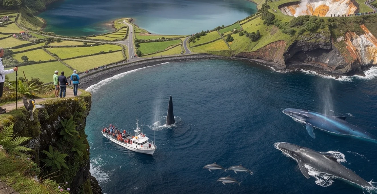
Whale watching capital: cetacean migration routes and sperm whale populations
The deep waters surrounding the Azores lie along major cetacean migration routes, transforming the archipelago into one of the best whale watching destinations in Europe, and indeed the world. More than 25 species of whales and dolphins have been recorded in these Atlantic waters, ranging from resident sperm whales to transient blue, fin, and humpback whales. The steep drop-offs close to shore—where the seafloor plunges from shallow coastal shelves to depths exceeding 1,000 metres—create ideal feeding grounds for deep-diving species. This unique oceanographic setting, combined with robust regulations on whale watching practices, makes the Azores a model for sustainable marine wildlife tourism.
Historically, several Azorean islands hosted active whaling communities, with shore-based whaling stations operating well into the 20th century. Today, however, the industry has transformed entirely: former whalers have become whale watching guides, using their intimate knowledge of local waters to locate and interpret cetacean behaviour for visitors. What better way to understand local culture than to hear first-hand accounts from those who once hunted whales but now protect them? This shift from exploitation to conservation-oriented tourism underscores the region’s broader commitment to sustainable use of marine resources, aligning economic development with biodiversity protection.
Pico island: year-round resident sperm whale pods in atlantic deep waters
Pico Island, with its dramatic volcanic peak rising sharply from the sea, serves as a key base for observing resident sperm whale (Physeter macrocephalus) populations. These deep-diving giants frequent the deep canyons and offshore waters between Pico, Faial, and São Jorge, where they hunt squid at depths that can exceed 1,000 metres. Unlike migratory baleen whales, many sperm whales remain in the Azores’ waters throughout the year, forming stable social units of females and juveniles. Adult males, in contrast, tend to roam more widely across the North Atlantic, occasionally returning to these productive feeding grounds.
Modern whale watching operators around Pico use small to medium-sized vessels and often rely on traditional “vigias”—shore-based lookouts armed with binoculars and radios—to spot cetaceans. This system, originally developed for whaling, now enables efficient and low-impact wildlife viewing, reducing the time boats spend searching at sea. Responsible companies adhere to strict codes of conduct, maintaining minimum distances, limiting the number of boats per animal group, and avoiding sudden manoeuvres. When you witness a sperm whale lifting its massive tail fluke before a deep dive, you are seeing not only a spectacular natural event, but also the outcome of decades of policy decisions that have prioritised conservation and science-based tourism.
Blue whale and fin whale spring migration patterns along faial channel
Each spring, the Azores become a staging ground for some of the planet’s largest animals: blue whales (Balaenoptera musculus) and fin whales (Balaenoptera physalus). As they migrate from low-latitude wintering grounds toward nutrient-rich feeding areas in the North Atlantic, many individuals transit through the waters around Faial and Pico. The Faial Channel, in particular, offers prime conditions for these baleen whales to refuel, thanks to seasonal plankton blooms stimulated by mixing currents and upwelling. Sightings typically peak between March and May, attracting researchers and dedicated whale watchers eager for a glimpse of these impressive migratory giants.
Seeing a blue whale’s massive back and diminutive dorsal fin glide across the surface is an experience that tends to redefine one’s sense of scale—like watching a moving island passing silently through the waves. Operators that specialise in spring whale watching often combine excursions with educational briefings on baleen whale ecology, climate change impacts, and ongoing photo-identification projects. By contributing your sightings and photographs to citizen science initiatives, you can help scientists track individual whales across ocean basins, revealing patterns of site fidelity and migration timing. In this way, a single whale watching trip can simultaneously provide unforgettable memories and valuable data for marine conservation.
Risso’s dolphin and bottlenose dolphin resident communities
In addition to large whales, the Azores support several resident dolphin communities that can be seen year-round. Among the most frequently observed are Risso’s dolphins (Grampus griseus) and common bottlenose dolphins (Tursiops truncatus). Risso’s dolphins are particularly distinctive, with pale, heavily scarred bodies that record a lifetime of social interactions and squid encounters, giving them a weathered, almost ghostly appearance. They tend to favour deeper offshore waters, where they engage in high-energy foraging dives, while bottlenose dolphins often patrol closer to shore, occasionally accompanying boat bows or surfing waves.
For many visitors, encounters with these resident dolphins are among the most memorable aspects of an Azores marine tour. Watching a pod of bottlenose dolphins leap alongside the boat or a group of Risso’s dolphins resting at the surface offers a window into complex social lives that science is only beginning to fully decode. At the same time, growing demand for dolphin encounters underscores the importance of adhering to strict guidelines on approach distances, engine noise, and trip frequency. By choosing certified operators and respecting the animals’ space, you help ensure that these charismatic species remain a daily presence in Azorean waters rather than a stressed, declining resource.
Undiscovered coastal landscapes: praia do porto pim and fajã grande formations
While much attention focuses on volcanoes and open-ocean wildlife, the Azores’ coastal landscapes offer equally compelling reasons to visit. On Faial, Praia do Porto Pim presents a gently curving bay framed by low hills and historical buildings, once a hub for whaling activity and maritime trade. Its sheltered, sandy beach—relatively rare in an archipelago dominated by rocky shorelines—provides calm waters suitable for swimming and kayaking, especially during the summer months. Behind the beach, restored warehouses and a small whaling museum tell the story of how this quiet bay was once at the centre of a bustling, if now controversial, industry.
In contrast, Fajã Grande on Flores Island showcases the dramatic interplay between steep volcanic cliffs and narrow coastal plains formed by landslides and lava flows. Here, vertical walls rise hundreds of metres above the Atlantic, pierced by multiple waterfalls that cascade down to the lush fields and traditional houses clustered below. These “fajãs”—low-lying platforms at the foot of cliffs—result from centuries of mass-wasting events, where portions of the island’s flanks collapsed toward the sea. Walking along the coastal paths in Fajã Grande, you can observe how human communities have adapted to this dynamic environment, cultivating small plots of land and building stone walls in a setting that feels almost like the edge of the world.
Atlantic hiking trails: pico mountain summit routes and coastal cliff pathways
For many travellers, discovering the Azores means lacing up hiking boots and exploring an extensive network of trails that traverse volcanic ridges, crater rims, laurel forests, and rugged coastlines. The islands offer routes suitable for all skill levels, from short, family-friendly walks to full-day ascents of towering stratovolcanoes. Well-marked trails, maintained by regional authorities, often include wayfinding posts and information boards that highlight geological features, native plants, and cultural landmarks along the way. If you enjoy combining physical challenge with constant scenery changes, the Azores’ hiking routes feel almost purpose-built for immersive, slow-paced exploration.
One of the great advantages of hiking in this Atlantic archipelago is the diversity of landscapes you can experience in a relatively short distance. Within a single day, you might start by following a coastal cliff pathway with sweeping views of the ocean, then climb inland through hydrangea-lined lanes and pastures, and finally enter dense cloud forest at higher elevations. Of course, weather can change quickly, with fog, rain, and sunshine often cycling through in a matter of hours—much like rapidly turning pages in a picture book. By checking local forecasts, carrying appropriate rain gear, and respecting trail closures, you can safely enjoy some of the most memorable hiking experiences in Europe.
Mount pico ascent: 2,351-metre stratovolcano trekking technicalities
Dominating the skyline of Pico Island, Mount Pico is Portugal’s highest peak at 2,351 metres above sea level, and a bucket-list objective for experienced hikers visiting the Azores. The standard ascent route begins at the Casa da Montanha (Mountain House) at around 1,200 metres elevation, where trekkers must register, receive a GPS tracker, and attend a short safety briefing. From there, the trail climbs steeply over loose volcanic rocks and compacted ash, following a series of numbered markers that guide you toward the main crater and, eventually, the summit cone known as Piquinho. Although the total distance is relatively modest—typically 7–10 kilometres round trip—the elevation gain and rough terrain make this a demanding hike, best suited to those with good fitness and proper equipment.
Weather conditions on Mount Pico can change rapidly, with strong winds, dense fog, and sudden temperature drops even during summer. Many hikers underestimate these challenges, assuming that a “short” route distances automatically translate into an easy climb. In reality, ascending Pico is more akin to a high-intensity stair workout on uneven, shifting ground, followed by a careful descent that can be harder on the knees than the climb itself. Sensible precautions include wearing sturdy hiking boots, bringing layers and a waterproof jacket, carrying at least 2 litres of water per person, and starting early to avoid afternoon cloud build-up. Local regulations cap the number of climbers on the mountain at any one time, a measure that both protects the fragile volcanic substrate and improves the overall summit experience.
Flores island’s rocha dos bordões: vertical basalt column trail network
On Flores, often considered one of the most scenic islands in the Azores, Rocha dos Bordões stands out as a striking geological monument. This formation consists of towering vertical basalt columns, resembling a giant pipe organ or a cluster of monumental reeds frozen in stone. These columns formed as thick basaltic lava flows cooled and contracted, creating polygonal fractures similar to those seen at the Giant’s Causeway in Northern Ireland or the Devil’s Postpile in California. Over time, erosion stripped away surrounding material, leaving the more resistant columnar structures prominently exposed on the hillside.
Several interconnected trails and viewpoints allow you to appreciate Rocha dos Bordões from different angles and distances. Shorter routes bring you close to the base of the columns, where you can examine the hexagonal patterns and overlying vegetation, while longer circuits integrate the formation into broader hikes through Flores’ highland moorlands and crater lakes. As you walk these paths, it can be helpful to imagine basalt as a viscous liquid that once flowed like thick honey, later cracking into geometric prisms as it cooled—an analogy that makes complex volcanic processes more intuitive. Because Flores receives high rainfall, trails can be muddy and slippery, so waterproof boots and trekking poles are recommended for a comfortable and safe hike.
Mistério da prainha lava field: santa maria’s coastal walking routes
Santa Maria, the southeasternmost and geologically oldest island of the Azores, presents a different volcanic story, with extensive erosion revealing layered formations and fossil-bearing sediments. Among its most intriguing features is the Mistério da Prainha lava field, a coastal area shaped by relatively recent basaltic eruptions that overran earlier landscapes and solidified into rugged, black rock. This stark terrain, dotted with gas bubbles and twisted rope-like textures known as pahoehoe, contrasts sharply with the island’s nearby golden sand beaches and green pastures. In some places, you can clearly see how lava once flowed directly into the sea, creating new land as it met the Atlantic’s cooling waters.
Coastal walking routes around Mistério da Prainha offer an excellent introduction to Santa Maria’s volcanic heritage, combining geological interpretation with expansive ocean views. Waymarked trails guide you across the lava field and past low sea cliffs, where waves continuously sculpt and undercut the basaltic shoreline. For those curious about how islands grow and evolve, this landscape functions like an open-air textbook, with flows, vents, and fractured surfaces illustrating key concepts in volcanology. As always in the Azores, it is wise to respect safety signs, avoid venturing too close to unstable cliff edges, and carry sun protection, as the dark lava can reflect and amplify heat on clear days.
Sustainable tourism infrastructure: low-density accommodation and flight accessibility challenges
Unlike many European holiday destinations that have embraced high-density resort development, the Azores have pursued a more measured approach to tourism infrastructure. Accommodation options tend to be small-scale and dispersed, ranging from family-run guesthouses and rural tourism cottages to boutique hotels housed in renovated heritage buildings. This low-density model helps preserve the archipelago’s tranquil atmosphere, reducing pressures on local resources and limiting visual intrusion on natural landscapes. At the same time, it requires visitors to plan ahead, especially during peak travel months, as rooms in popular locations can book out weeks or even months in advance.
Transport to and within the archipelago presents its own set of opportunities and constraints. Direct international flights connect key islands like São Miguel and Terceira to major European hubs and some North American cities, while inter-island travel relies on a combination of regional flights and seasonal ferries. Because air and sea connections can be affected by weather and limited capacity, particularly in winter, travellers are wise to build flexibility into their itineraries—perhaps by allowing extra days between critical connections or concentrating on a smaller cluster of islands rather than attempting to visit all nine in a single trip. Think of planning an Azores itinerary as piecing together a dynamic puzzle: rewarding and manageable, provided you allow enough time and avoid trying to force every piece into place at once.
From a sustainability perspective, regional authorities have implemented various measures to balance tourism growth with environmental protection, including strict building regulations in coastal zones, caps on sensitive activities such as Mount Pico ascents, and ambitious targets for renewable energy production. As a visitor, you can contribute to this vision by choosing eco-certified accommodations, supporting local food producers and guides, and prioritising low-impact activities such as hiking, birdwatching, and cultural visits. In doing so, you become part of a broader community that recognises the Azores not merely as a scenic backdrop, but as a living, evolving environment whose long-term well-being depends on thoughtful, responsible engagement from everyone who sets foot on these extraordinary Atlantic islands.