The Scottish Highlands represent one of Europe’s most primordial landscapes, where ancient geological forces have sculpted a terrain that defies conventional beauty. This vast wilderness stretches across nearly half of Scotland, encompassing dramatic mountain ranges, pristine lochs, and ecosystems that have evolved in isolation for millennia. From the towering peaks of Ben Nevis to the mystical waters of Loch Ness, the Highlands offer visitors an encounter with landscapes that feel genuinely otherworldly, shaped by forces spanning billions of years and cultural traditions reaching back centuries.
What transforms the Scottish Highlands from merely spectacular scenery into something transcendent is the convergence of extraordinary geological diversity, unique climatic conditions, and cultural heritage that remains vibrantly alive. The region’s complex topography creates microclimates where Arctic-alpine plants flourish alongside temperate species, whilst ancient Gaelic place names preserve knowledge of landscapes that modern science is only beginning to fully understand.
Geological formations and ancient landscapes of the scottish highlands
The geological foundation of the Scottish Highlands tells a story spanning over three billion years, making it one of the oldest landscapes on Earth. This extraordinary temporal depth becomes immediately apparent when examining the region’s rock formations, which represent some of the most ancient materials found anywhere in Europe. The complexity of Highland geology results from multiple mountain-building events, each leaving distinctive signatures in the landscape that visitors encounter today.
Precambrian lewisian gneiss complex in the northwest highlands
The Lewisian Gneiss Complex represents the geological foundation of the Northwest Highlands, comprising rocks formed between 3.0 and 1.7 billion years ago during the Precambrian era. These metamorphic rocks, amongst the oldest in Europe, create the characteristic knobbly, ice-scoured landscape of Assynt and the far northwest. The gneiss appears as banded grey and pink rock, its distinctive striped pattern resulting from extreme pressure and temperature conditions deep within ancient mountain ranges.
Visitors exploring areas around Scourie and Loch Assynt encounter landscapes where this ancient foundation breaks through younger rock layers, creating dramatic unconformities visible to the naked eye. The Lewisian basement forms the platform upon which younger geological stories unfold, its resistance to erosion creating the distinctive stepped topography characteristic of the far northwest Highlands.
Caledonian orogeny impact on ben nevis and cairngorms massif
The Caledonian mountain-building event, occurring between 490 and 390 million years ago, fundamentally shaped the central and eastern Highlands. This massive tectonic collision between ancient continents created the mountain ranges we recognise today as the Cairngorms and the area surrounding Ben Nevis. The Cairngorms massif represents a vast granite intrusion, cooled slowly deep within the Earth’s crust before being exposed through millions of years of erosion.
Ben Nevis itself showcases the complexity of Caledonian geology, with its summit plateau formed from volcanic rocks whilst its base comprises metamorphic schists and slates. The mountain’s characteristic profile results from differential erosion of these varied rock types, creating the dramatic cliff faces and corries that challenge climbers and captivate visitors. The Caledonian influence extends throughout the central Highlands, creating the distinctive northeast-southwest trending valleys and ridges that define the region’s topographical grain.
Glacial erosion patterns in glen coe and loch katrine valleys
Quaternary glaciation carved the Highland landscape into its present dramatic form, with ice sheets and valley glaciers excavating the deep glens and lochs that characterise the region today. Glen Coe exemplifies glacial erosion at its most spectacular, where ice carved through volcanic rocks to create a U-shaped valley of extraordinary grandeur. The Three Sisters peaks and the Aonach Eagach ridge demonstrate how glacial action exploited weaknesses in the rock structure, creating the knife-edge arêtes and pyramidal peaks beloved by mountaineers.
Loch Katrine and the Trossachs region showcase gentler glacial sculpting, where ice carved through Highland schists to create the characteristic landscape of interlocking spurs and ribbon lakes. These glacial valleys demonstrate how
these seemingly serene landscapes were once dominated by powerful rivers of ice. When you trace a finger along a modern map of the Scottish Highlands, you are effectively following the pathways of these vanished glaciers, whose legacy includes hanging valleys, over-deepened basins now filled by lochs, and smoothed rock outcrops bearing parallel striations aligned with ancient ice flow.
Torridonian sandstone formations of assynt and wester ross
In contrast to the ancient Lewisian Gneiss, the Torridonian Sandstone formations of Assynt and Wester Ross represent younger, yet still Precambrian, sediments laid down around 1.2 to 1.0 billion years ago. These thick, red-brown sandstones were deposited in vast river and lake systems, then uplifted and dissected to form some of the Highlands’ most iconic mountains. Peaks such as Suilven, Stac Pollaidh, and Liathach rise as isolated monoliths, their steep flanks and flat summits giving them an almost architectural presence in the landscape.
What makes these Torridonian mountains feel like a journey into another world is their combination of age, colour, and form. Their layered sediments, tilted and weathered, are often compared to a colossal stack of books whose pages have been ruffled by time. As you walk beneath their cliffs or follow airy ridgelines, you can literally read the Earth’s deep past in the cross-beds, conglomerates, and fault lines. For geology enthusiasts, this part of the Scottish Highlands is effectively an open-air textbook, while for casual visitors it simply feels like stepping into a prehistoric film set.
Unique ecosystems and endemic highland flora
The Scottish Highlands are not only defined by their rocks and glens; they are also a mosaic of distinctive ecosystems, many of which host rare or endemic species. Because of the varied topography and the interplay between maritime and continental influences, the region supports everything from temperate rainforests to Arctic-alpine plant communities. For anyone who loves nature, understanding these habitats transforms a scenic drive into a deeper encounter with living, breathing landscapes that are as fragile as they are beautiful.
Atlantic oakwood habitats in argyll and bute
Along the wet, mild western seaboard, particularly in Argyll and Bute, fragments of Atlantic oakwoods cling to steep slopes and sheltered glens. Sometimes described as “temperate rainforests,” these woodlands are dominated by sessile oak and hazel, their trunks draped in mosses, liverworts, and lichens that thrive in the moist Atlantic air. The combination of high rainfall and relatively frost-free winters creates conditions that are rare elsewhere in Europe, allowing a profusion of epiphytes to blanket branches like a living tapestry.
As you walk through these Atlantic oakwoods, perhaps on a trail near Loch Awe or Knapdale, you enter a world that feels more akin to a Celtic myth than to modern Britain. The forest floor is often carpeted with bluebells in spring and ferns in summer, while species such as the European otter and pine marten find refuge in the dense undergrowth. Conservation designations like Special Areas of Conservation (SACs) and Sites of Special Scientific Interest (SSSIs) help protect these remnants, but visitors can also play a part: staying on marked paths, avoiding disturbance to sensitive habitats, and supporting local conservation charities all help ensure these “rainforests” endure.
Caledonian pine forest remnants at glen affric and rothiemurchus
Further inland, the remnants of the ancient Caledonian pine forest offer a very different but equally evocative scene. Glen Affric and Rothiemurchus are two of the finest surviving examples of this once-vast woodland, dominated by Scots pine with characteristically twisted trunks and orange-tinged bark. These native pinewoods, interspersed with birch, rowan, and juniper, provide critical habitat for some of Scotland’s most iconic wildlife, including red squirrels, capercaillie, and crested tits.
Walking through these forests can feel like stepping back thousands of years, into a Scotland that existed long before intensive agriculture and large-scale deforestation. Today, only an estimated 1–2% of the original Caledonian forest remains, but active restoration projects are reversing centuries of decline. When you hike in Glen Affric or explore the trails of Rothiemurchus, you may notice new native saplings protected by deer fences and carefully managed grazing. These efforts mean that visitors in future decades will encounter richer, more continuous woodland – a living reminder that the Scottish Highlands are not just ancient, but also constantly renewing themselves.
Montane vegetation communities on beinn eighe and ben lawers
Above the tree line, the Highlands take on an increasingly Arctic character. On mountains such as Beinn Eighe in Wester Ross and Ben Lawers in Perthshire, harsh conditions of wind, cold, and thin soils give rise to specialised montane vegetation communities. Here you find dwarf shrubs, cushion plants, and delicate Alpine flowers clinging to rock ledges and scree slopes, surviving where taller competitors cannot. It is a world of miniature plants with enormous resilience, a botanical equivalent of a high-altitude frontier town.
Beinn Eighe, the UK’s first National Nature Reserve, is renowned for its combination of ancient pinewoods and high-level habitats. Ben Lawers, meanwhile, is famous among botanists for harbouring some of Britain’s rarest Alpine plants, including Alpine forget-me-not and snow gentian. If you plan to explore these montane environments, you quickly appreciate how vulnerable they are: a single mis-placed boot can damage vegetation that has taken years to establish. Following established paths and avoiding erosion-prone shortcuts is more than a courtesy; it is essential for preserving these high-altitude ecosystems for future generations of walkers and climbers.
Blanket bog ecosystems of the flow country extension
In the far north of the Scottish Highlands, the landscape flattens into a vast, seemingly featureless plain, but this is one of the most ecologically significant areas in Europe. The Flow Country, extending into Sutherland and Caithness, is the largest expanse of blanket bog in the world, covering around 4,000 square kilometres. These deep peatlands have been accumulating organic matter for over 10,000 years, locking away an estimated 400 million tonnes of carbon – more than many temperate forests combined.
At first glance, blanket bog might look like empty moorland, but up close you discover a rich tapestry of sphagnum mosses, cotton grass, dwarf shrubs, and insect-eating sundews. It is an ecosystem adapted to waterlogged, nutrient-poor conditions that would defeat most plants. In the context of climate change, these peatlands have gained renewed importance as “carbon vaults” whose integrity is crucial to global emissions targets. When you travel through this part of the Highlands, whether by road or on guided walks, you are moving across a living archive of both ecological and climatic history – a gentle reminder that not all wilderness is dramatic, but it can still be profoundly important.
Cultural heritage and gaelic landscape terminology
The Scottish Highlands are as much a cultural landscape as a physical one, and Gaelic plays a central role in how these places are understood and experienced. For centuries, Gaelic speakers used a rich vocabulary to describe every nuance of terrain, water, and weather. Many of those words survive today as place names: when you read a map of the Highlands, you are effectively reading a cultural palimpsest that encodes local knowledge about the land.
Common elements such as ben or beinn (mountain), glen (valley), and loch (lake or sea inlet) are widely recognised, but the lexicon runs far deeper. Terms like coire (corrie or cirque), slaid (steep slope), and allt (burn or stream) tell you not just what is there, but how it behaves – whether it is steep, sheltered, or likely to flood. For hikers and climbers, learning even a handful of Gaelic terms turns a topographic map into a story about how generations of people have interacted with the terrain.
This cultural layer is not merely historical; Gaelic is still spoken in parts of the Highlands and Islands, and community efforts continue to revitalise the language. You may notice bilingual road signs, hear Gaelic in local schools, or encounter traditional songs and stories that reference specific hills and lochs. By tuning into this linguistic heritage, you engage with the Highlands on a deeper level, recognising that what feels like a journey into another world is also a journey into another way of seeing and naming the Earth.
Mystical weather phenomena and atmospheric conditions
If the geology and ecology of the Scottish Highlands provide the stage, the weather supplies the ever-changing light and mood. The region’s position at the meeting point of Atlantic air masses, mountainous terrain, and deep sea lochs generates atmospheric conditions that can shift within minutes. This volatility is one reason the Highlands feel so otherworldly: you can step into a sunlit glen and, half an hour later, find yourself surrounded by mist that muffles sound and softens the landscape into something dreamlike.
Orographic precipitation effects on the west highland way
One of the most striking meteorological features in the Highlands is orographic precipitation, where moist Atlantic air is forced to rise over mountain ranges, cooling and condensing into cloud and rain. Nowhere is this more evident than along the West Highland Way, the long-distance trail that winds from Milngavie near Glasgow to Fort William. As you walk northward, you can often see clouds piling up against the southern flanks of ranges like the Arrochar Alps and the Mamores, delivering frequent showers to the western slopes while the eastern side may remain relatively dry.
For walkers, understanding this orographic effect is more than an academic curiosity – it is a practical tool for planning. It explains why waterproofs are non-negotiable on a multi-day trek, and why route descriptions often warn of notoriously boggy sections where rainfall is consistently high. Have you ever wondered why one valley is lush and waterlogged while the next, just over a ridge, feels noticeably drier? Orographic precipitation is the invisible sculptor behind those differences, redistributing moisture in patterns that shape both vegetation and human land use.
Temperature inversion layers above loch lomond basin
Another enchanting phenomenon you may witness in the Highlands is the temperature inversion, particularly in basins like Loch Lomond on calm autumn or winter mornings. Normally, air temperature decreases with altitude, but during an inversion a layer of cold air becomes trapped near the ground, while warmer air sits above. The result, from a hilltop vantage point, can be spectacular: a dense sea of cloud filling the loch basin, with mountain tops emerging like islands from a white ocean.
Experiencing an inversion first-hand is one of those moments that make the Scottish Highlands feel definitively “not of this world.” You may start your day in damp, chilly fog at loch level, then ascend a modest summit such as Conic Hill to find yourself in brilliant sunshine above the cloud. Photographers in particular seek out these conditions, but they also serve as a subtle reminder of how complex and layered the Highland atmosphere can be. For safety, it is important to remember that while conditions may look benign from above, visibility and temperatures can be very different down in the glens.
Maritime climate influence on skye’s cuillin ridge
On the Isle of Skye, the Cuillin Ridge showcases how the maritime climate can transform a mountain landscape into a place of near-mythic intensity. The Cuillin’s jagged peaks rise abruptly from the sea, often cloaked in fast-moving cloud and lashed by Atlantic weather systems. Moisture-laden air arriving from the ocean condenses rapidly as it encounters the ridge, leading to frequent showers, sudden squalls, and dramatic shifts in visibility that can turn a straightforward scramble into a serious mountaineering challenge.
For climbers and walkers drawn to the Cuillin, this maritime influence demands respect and careful preparation. Forecasts can change quickly, rock can remain slick long after rain has passed, and navigation on the mist-shrouded ridges requires both skill and experience. Yet it is precisely this volatile mix of oceanic weather and sharp relief that gives the Cuillin its otherworldly aura. Standing on a narrow crest with the Atlantic stretching away beneath swirling cloud, you understand why so many visitors describe Skye as a place where Earth and sky feel unusually close together.
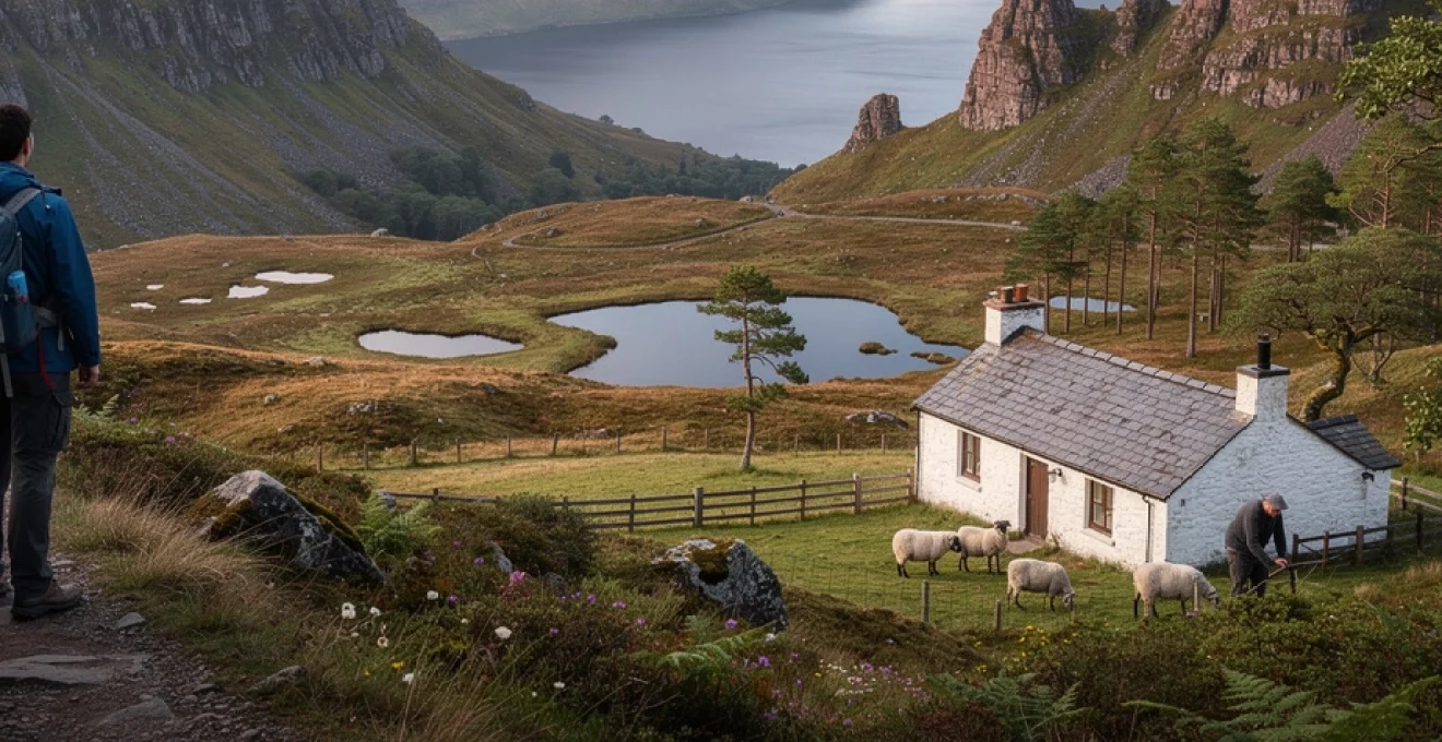
Remote highland settlements and traditional crofting communities
Beyond the headline landscapes and popular trails, the Scottish Highlands are dotted with remote settlements and crofting communities that maintain a close, often precarious relationship with the land. Crofting – a traditional system of small-scale tenant farming – has shaped much of the Highland cultural landscape since the 19th century. Crofters typically combine limited arable plots with shared grazing on common land, balancing livestock, seasonal work, and, increasingly, income from tourism and conservation projects.
In places such as the west coast of Sutherland, the Isle of Lewis, or the scattered townships of Skye, you can still see this way of life in action. Stone ruins of abandoned crofts stand beside renovated homes, telling stories of past depopulation during the Highland Clearances and more recent efforts at repopulation and community ownership. For visitors, staying in locally run guesthouses, buying produce from small farm shops, or attending village events offers a way to connect with this living heritage. It also raises thoughtful questions: how do these communities balance the desire to preserve tradition with the need to adapt to a changing economy and climate?
Many crofting areas now sit within or adjacent to protected landscapes such as National Scenic Areas or UNESCO Biosphere Reserves, intertwining local livelihoods with environmental stewardship. Community land trusts have purchased large estates, giving residents more control over decisions about renewable energy, rewilding, and tourism infrastructure. When you travel through these regions, you are not just moving across a picturesque backdrop; you are passing through places where people are actively negotiating what the future of the Highlands should look like, and how this “other world” can remain viable for those who call it home.
Adventure tourism infrastructure in wilderness areas
The sense that the Scottish Highlands are a journey into another world has helped transform the region into a global destination for adventure tourism. From long-distance trails like the West Highland Way and the Cape Wrath Trail to mountain-bike networks, canoe routes, and winter climbing venues, a substantial infrastructure now supports visitors seeking wild experiences. Well-maintained paths, waymarking, bothies, and mountain rescue services all make it easier to explore remote areas while reducing the impact on fragile environments.
This growth, however, comes with both opportunities and challenges. On the positive side, adventure tourism provides vital income for remote communities, sustaining local businesses, guiding companies, and accommodation providers. It also encourages investment in conservation, with many projects funded partly by visitor donations and outdoor tourism revenue. On the other hand, increased footfall can accelerate path erosion, disturb wildlife, and strain limited rural services if not carefully managed. Have you ever noticed heavily braided trails or litter in what should be pristine corries? These are visible signs of the pressure that popular routes can face.
Responsible adventure infrastructure now emphasises low-impact design and education. Path restoration projects use natural materials to blend with the landscape, car parks and visitor centres provide clear information on Leave No Trace principles, and digital tools offer real-time guidance on weather, access, and hazards. As a visitor, you become part of this system: choosing public transport where possible, supporting certified local guides, and respecting access codes that allow you to roam while safeguarding private land and sensitive habitats. When all of these elements align, the Scottish Highlands remain what they have always been – a place where you can step beyond the everyday – while ensuring that this remarkable world endures for those who follow.